


Presenting Global Coastal Map @10m
- Marco Peters

- Jun 2
- 3 min read
This is my first blog post in a long time, and fittingly, it's about a dataset that I created and published some time ago.
Coastal regions are among the most dynamic and ecologically valuable environments on Earth. They host rich biodiversity, support fisheries and tourism, protect inland areas from storms, and serve as hubs for human settlement. Yet these same regions are also some of the most vulnerable - facing rising sea levels, erosion, habitat loss, and increasing human pressure.
To better understand and protect these fragile zones, high‑resolution, globally consistent coastal data is essential. That is exactly what the Global High‑Resolution Coastal Map delivers: a 10‑meter global dataset designed to help researchers, conservationists, and decision‑makers analyse coastlines with unprecedented clarity.
A New Global Coastal Mapping
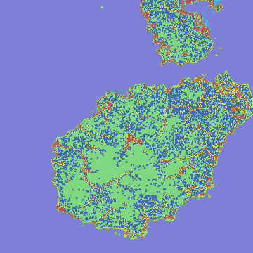
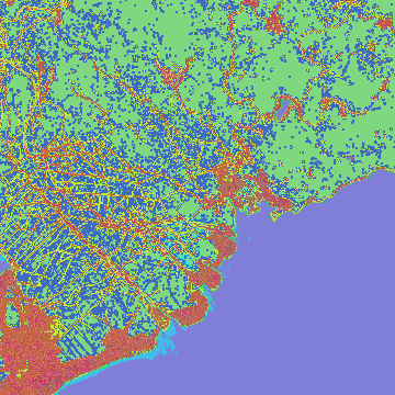
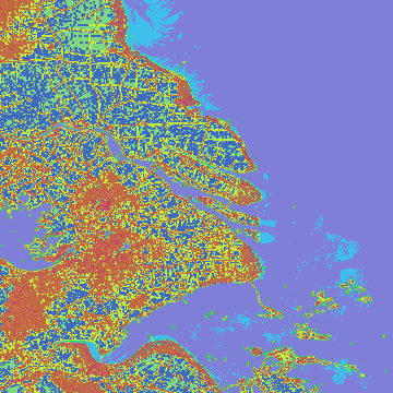
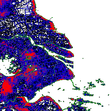
The Coastal Map provides four core indicators that together describe the structure and dynamics of coastal zones:
Land–Water Indicator
Coastline Indicator
Intertidal Area Indicator
Vicinity Indicator (land near water & water near land)
These indicators are encoded using ten mask classes, allowing users to distinguish land, water, coastline pixels, tidal flats, and varying degrees of coastal influence.
All data is provided at 10 m resolution and organized into 3°×3° tiles, making global analysis manageable even for large‑scale workflows.


How the Map Was Built
The Coastal Map integrates three authoritative global datasets, each contributing a crucial piece of the puzzle.
1. Land–Water Indicator
This indicator is derived primarily from ESA WorldCover 10 m 2021, a global land‑cover product. Pixels classified as water (value 80) or no‑data (value 0) are treated as water; all others are land.
For Antarctica—where optical land‑cover products struggle—the map uses the BAS Antarctica Seamask 2023, inverted and reprojected to match the global grid.
2. Coastline Indicator
To extract coastlines, the dataset applies Sobel edge detection in four directions (north, east, south, west) on the generated Land-Water indicator. The combined result produces a clean, two‑pixel‑wide coastline—one pixel on land, one on water.
This method ensures consistency across the globe, independent of regional differences in land‑cover classification.
3. Intertidal Area Indicator
Intertidal zones, areas regularly flooded and exposed by tides, are mapped using the Global Intertidal Change Map 2019. The dataset includes tidal wetland probabilities (0–100), which are thresholded differently for land and water:
Water pixels: threshold ≥ 20
Land pixels: threshold ≥ 50
This dual‑threshold approach reflects the different spectral characteristics of tidal flats depending on tidal state and surface conditions.
4. Vicinity Indicator
Perhaps the most innovative part of the dataset, the Vicinity Indicator measures how strongly land and water influence each other within a 200‑pixel corridor around the coastline.
A custom kernel spreads influence outward from coastline pixels, generating values from –100 to +100:
Positive values: water influenced by nearby land
Negative values: land influenced by nearby water
These values are then categorized into low, mid and high vicinity classes. This indicator is particularly useful for ecological modelling, coastal risk assessment, and habitat mapping.

Open Data for a Global Community
The Coastal Map is published under the CC‑BY 4.0 license, meaning it can be used, remixed, and integrated into commercial or scientific projects as long as proper attribution is given.
Suggested citation:
Peters, M. (2024). Global High‑Resolution Map for Coastal Areas. EOMasters. doi:10.5281/zenodo.10548225


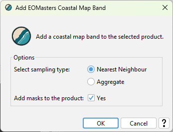
Support by EOMasters Toolbox Pro
The coastal map is supported by the EOMasters Toolbox Pro. Which is available as plugin for ESA SNAP. A coastal map band can easily be added to existing data products or during data processing via an operator.
More about the technical details can be found in the tech note which is available at Zenodo.
Tschüss & Goodbye
Marco

Comments